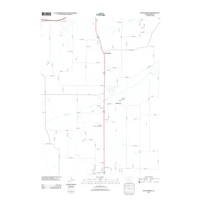
2013 Map of Scotch Ridge
USGS Topo · Published 2013About this map
Scotch Ridge and the nearby settlement of Summerset anchor this rural landscape just south of the Des Moines metro area, where the terrain is defined by the convergence of several major watercourses. The Middle River meanders across the central portion of the sheet, joined by smaller tributaries like Plug Run and Butcher Cr. This 2013 survey illustrates a transition from agricultural use to low-density residential development, evidenced by the grid of named roads such as Scotch Ridge Rd and Beardsley St intersecting with the primary corridor of US Highway 65/69. Local aviation is a notable theme here, with both Tuinstra Airfield and Laverty Field Airport positioned near the river valleys. The drainage patterns of N River and Cavitt Cr further shape the geography of Warren County in this era.
Find a feature on this map
86 named features on this map. Tap any name to fly to it.
Don’t see what you’re looking for? This feature index may not catch every label — zoom into the map to look around manually.
Map Details
Editions of this 2013 Scotch Ridge Map
This is the sole edition of this map. No revisions or reprints were ever made.
Other maps of this area

1905 · Des Moines
USGS Topo · 1:62,500

1907 · Des Moines
USGS Topo · 1:62,500

1910 · Milo
USGS Topo · 1:62,500

1930 · Mitchellville
USGS Topo · 1:62,500

1931 · Indianola
USGS Topo · 1:62,500

1954 · Des Moines
USGS Topo · 1:250,000

1956 · Des Moines
USGS Topo · 1:250,000

1956 · Des Moines SW
USGS Topo · 1:24,000

1956 · Des Moines SE
USGS Topo · 1:24,000

1956 · Des Moines
USGS Topo · 1:62,500