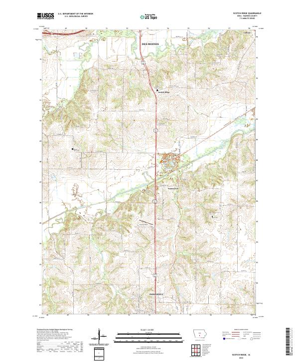
2022 Map of Scotch Ridge
USGS Topo · Published 2022About this map
Indianola anchor the southern edge of this Warren County landscape, where the prairie topography is defined by the winding courses of the Middle River and N River. This modern survey illustrates the rural-suburban interface south of Des Moines, showing a network of agricultural lands punctuated by small settlements like Summerset and Scotch Ridge. The transition from historic township grids to contemporary recreational use is evident in the presence of the Summerset Trl and various branching paths like Extra Credit Trl and Riverside Trl.
Find a feature on this map
55 named features on this map. Tap any name to fly to it.
Don’t see what you’re looking for? This feature index may not catch every label — zoom into the map to look around manually.
Map Details
Editions of this 2022 Scotch Ridge Map
This is the sole edition of this map. No revisions or reprints were ever made.
Other maps of this area

1905 · Des Moines
USGS Topo · 1:62,500

1907 · Des Moines
USGS Topo · 1:62,500

1910 · Milo
USGS Topo · 1:62,500

1930 · Mitchellville
USGS Topo · 1:62,500

1931 · Indianola
USGS Topo · 1:62,500

1954 · Des Moines
USGS Topo · 1:250,000

1956 · Des Moines
USGS Topo · 1:250,000

1956 · Des Moines SW
USGS Topo · 1:24,000

1956 · Des Moines SE
USGS Topo · 1:24,000

1956 · Des Moines
USGS Topo · 1:62,500