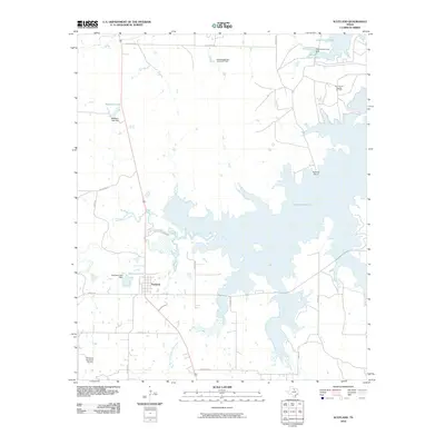
2010 Map of Scotland
USGS Topo · Published 2010About this map
Scotland occupies a central position in this Archer County landscape, situated just west of the expansive Lake Arrowhead. The town’s grid is defined by its proximity to Scotland Lake, where the Scotland Lake Dam regulates local waters. The geography is heavily influenced by the petroleum industry, evidenced by the scattered footprints of the Southvogtsberger- Strawn Oil Field, the Clay County Regular Oil Field, and the Northwest Windthorst Oil Field.
Find a feature on this map
28 named features on this map. Tap any name to fly to it.
Don’t see what you’re looking for? This feature index may not catch every label — zoom into the map to look around manually.
Map Details
Editions of this 2010 Scotland Map
This is the sole edition of this map. No revisions or reprints were ever made.
Other maps of this area

1931 · Archer City
USGS Topo · 1:62,500

1954 · Wichita Falls
USGS Topo · 1:250,000

1956 · Sloop Creek
USGS Topo · 1:24,000

1956 · Lake Wichita
USGS Topo · 1:24,000

1957 · Wichita Falls East
USGS Topo · 1:62,500

1957 · Wichita Falls West
USGS Topo · 1:62,500

1958 · Wichita Falls
USGS Topo · 1:250,000

1962 · Windthorst
USGS Topo · 1:24,000

1963 · Deer Creek
USGS Topo · 1:24,000

1963 · Scotland
USGS Topo · 1:24,000