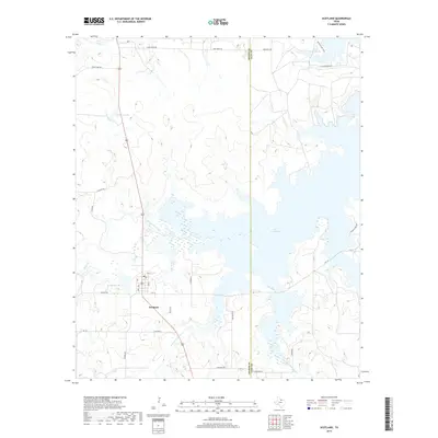
2019 Map of Scotland
USGS Topo · Published 2019About this map
Scotland serves as the central hub of this North Texas survey, located at the junction of FM 172 and a network of local roads including Hilbers RD and Schlabs LN. The landscape is dominated by the sprawling reaches of Lake Arrowhead, which extends across the eastern half of the quadrangle. This significant water body is fed and shaped by the Little Wichita River, while smaller catchments like Scotland Lake, Meddlers Lake, and Three Island Lake dot the surrounding prairie.
Find a feature on this map
29 named features on this map. Tap any name to fly to it.
Don’t see what you’re looking for? This feature index may not catch every label — zoom into the map to look around manually.
Map Details
Editions of this 2019 Scotland Map
This is the sole edition of this map. No revisions or reprints were ever made.
Other maps of this area

1931 · Archer City
USGS Topo · 1:62,500

1954 · Wichita Falls
USGS Topo · 1:250,000

1956 · Sloop Creek
USGS Topo · 1:24,000

1956 · Lake Wichita
USGS Topo · 1:24,000

1957 · Wichita Falls East
USGS Topo · 1:62,500

1957 · Wichita Falls West
USGS Topo · 1:62,500

1958 · Wichita Falls
USGS Topo · 1:250,000

1962 · Windthorst
USGS Topo · 1:24,000

1963 · Deer Creek
USGS Topo · 1:24,000

1963 · Scotland
USGS Topo · 1:24,000