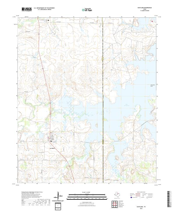
2022 Map of Scotland
USGS Topo · Published 2022About this map
The community of Scotland sits at the heart of this North Texas landscape, where the agricultural plains of Archer County meet the expansive waters of Lake Arrowhead. The town's layout is defined by a grid of numbered streets and lettered avenues, including Ave I and 8th St, centered near the Saint Boniface Cem. This map illustrates the vital intersection of water and land management in the region, tracing the path of the Little Wichita River as it feeds into the larger reservoir. To the north, the landscape is dotted with smaller water bodies such as Medders Lake and Three Island Lake, while the local history is anchored by the Lake Creek Cem near the northern boundary. The border between Archer and Clay counties bisects the eastern portion of the map, cutting directly through the middle of the lake and separating the primary settlement from Horseshoe Bend.
Find a feature on this map
36 named features on this map. Tap any name to fly to it.
Don’t see what you’re looking for? This feature index may not catch every label — zoom into the map to look around manually.
Map Details
Editions of this 2022 Scotland Map
This is the sole edition of this map. No revisions or reprints were ever made.
Other maps of this area

1931 · Archer City
USGS Topo · 1:62,500

1954 · Wichita Falls
USGS Topo · 1:250,000

1956 · Sloop Creek
USGS Topo · 1:24,000

1956 · Lake Wichita
USGS Topo · 1:24,000

1957 · Wichita Falls East
USGS Topo · 1:62,500

1957 · Wichita Falls West
USGS Topo · 1:62,500

1958 · Wichita Falls
USGS Topo · 1:250,000

1962 · Windthorst
USGS Topo · 1:24,000

1963 · Deer Creek
USGS Topo · 1:24,000

1963 · Scotland
USGS Topo · 1:24,000