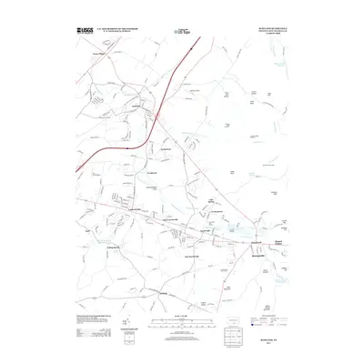
2013 Map of Scotland
USGS Topo · Published 2013About this map
Green Village and the village of Scotland anchor this 2013 topographic landscape in Franklin County, where the sprawling Scotland School For Vet Kids and the Waynesboro Junction rail crossing stand as significant local landmarks. The area is defined by the winding course of Conococheague Cr, which features the distinct Conococheague Island and is fed by smaller tributaries like Mountain Run and Phillaman Run.
Find a feature on this map
76 named features on this map. Tap any name to fly to it.
Don’t see what you’re looking for? This feature index may not catch every label — zoom into the map to look around manually.
Map Details
Editions of this 2013 Scotland Map
This is the sole edition of this map. No revisions or reprints were ever made.
Other maps of this area

1902 · Chambersburg
USGS Topo · 1:62,500

1909 · Fairfield
USGS Topo · 1:62,500

1919 · Newville
USGS Topo · 1:62,500

1923 · Shippensburg
USGS Topo · 1:62,500

1942 · Hagerstown
USGS Topo · 1:125,000

1942 · Gettysburg
USGS Topo · 1:125,000

1943 · Hagerstown
USGS Topo · 1:125,000

1943 · Chambersburg
USGS Topo · 1:62,500

1943 · Shippensburg
USGS Topo · 1:62,500

1944 · Scotland
USGS Topo · 1:31,680
Featured Places
- Chambersburg, PA
- Fayetteville, Greene Township
- Guilford Township, PA
- Scotland, Greene Township
- Duffield, Guilford Township