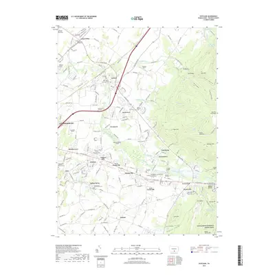
2019 Map of Scotland
USGS Topo · Published 2019About this map
Chambersburg serves as the western anchor of this landscape, where the urban edge meets the limestone-rich valley of Conococheague Creek. To the east, the terrain rises sharply into the wooded ridges of South Mountain, a transition marked by the Appalachian National Scenic Trail as it follows the high ground of Mt Cydonia and Big Pine Flat Ridge. This geographic divide has long dictated local development, with agricultural settlements like Scotland, Green Village, and Fayetteville clustered along the fertile lowlands and transport corridors.
Find a feature on this map
104 named features on this map. Tap any name to fly to it.
Don’t see what you’re looking for? This feature index may not catch every label — zoom into the map to look around manually.
Map Details
Editions of this 2019 Scotland Map
This is the sole edition of this map. No revisions or reprints were ever made.
Other maps of this area

1902 · Chambersburg
USGS Topo · 1:62,500

1909 · Fairfield
USGS Topo · 1:62,500

1919 · Newville
USGS Topo · 1:62,500

1923 · Shippensburg
USGS Topo · 1:62,500

1942 · Hagerstown
USGS Topo · 1:125,000

1942 · Gettysburg
USGS Topo · 1:125,000

1943 · Hagerstown
USGS Topo · 1:125,000

1943 · Chambersburg
USGS Topo · 1:62,500

1943 · Shippensburg
USGS Topo · 1:62,500

1944 · Scotland
USGS Topo · 1:31,680
Featured Places
- Chambersburg, PA
- Fayetteville, Greene Township
- Guilford Township, PA
- Scotland, Greene Township
- Duffield, Guilford Township