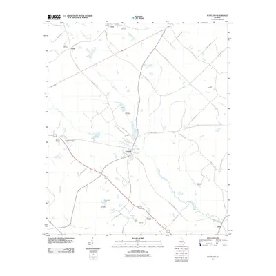
2011 Map of Scotland
USGS Topo · Published 2011About this map
The Little Ocmulgee River meanders across this rural landscape, serving as a primary drainage point for a network of creeks including Mill Creek and Sugar Creek. The settlement of Scotland sits as a central hub, while smaller communities like Erick, Avants, and Towns are distributed along the road networks. The region is characterized by agricultural and timber land interspersed with numerous managed water bodies such as Flanders Lake, Cleggs Lake, and Talmadge Lake, each supported by dedicated dams.
Find a feature on this map
52 named features on this map. Tap any name to fly to it.
Don’t see what you’re looking for? This feature index may not catch every label — zoom into the map to look around manually.
Map Details
Editions of this 2011 Scotland Map
This is the sole edition of this map. No revisions or reprints were ever made.
Other maps of this area

1953 · Waycross
USGS Topo · 1:250,000

1957 · Macon
USGS Topo · 1:250,000

1958 · Macon
USGS Topo · 1:250,000

1958 · Waycross
USGS Topo · 1:250,000

1964 · Macon
USGS Topo · 1:250,000

1970 · Scotland
USGS Topo · 1:24,000

1970 · Glenwood
USGS Topo · 1:24,000

1970 · Alamo
USGS Topo · 1:24,000

1970 · Jordan
USGS Topo · 1:24,000

1971 · Jacksonville NE
USGS Topo · 1:24,000