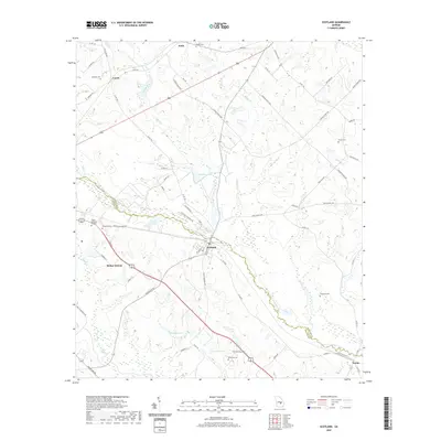
2020 Map of Scotland
USGS Topo · Published 2020About this map
The Little Ocmulgee River defines the lower half of this landscape, meandering through the borderlands between Wheeler and Telfair Counties. In this modern survey, the consolidated community of McRae-Helena and the town of Scotland serve as primary centers of settlement, connected by a network of rural routes like McRae Scotland Rd. The region’s genealogical footprint is well-preserved through numerous family and community burial grounds, including the Williams Cem, Hinson Cem, and Browning Cem.
Find a feature on this map
73 named features on this map. Tap any name to fly to it.
Don’t see what you’re looking for? This feature index may not catch every label — zoom into the map to look around manually.
Map Details
Editions of this 2020 Scotland Map
This is the sole edition of this map. No revisions or reprints were ever made.
Other maps of this area

1953 · Waycross
USGS Topo · 1:250,000

1957 · Macon
USGS Topo · 1:250,000

1958 · Macon
USGS Topo · 1:250,000

1958 · Waycross
USGS Topo · 1:250,000

1964 · Macon
USGS Topo · 1:250,000

1970 · Scotland
USGS Topo · 1:24,000

1970 · Glenwood
USGS Topo · 1:24,000

1970 · Alamo
USGS Topo · 1:24,000

1970 · Jordan
USGS Topo · 1:24,000

1971 · Jacksonville NE
USGS Topo · 1:24,000