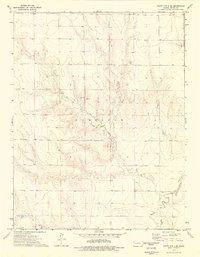
1974 Map of Scott City 4 NE
USGS Topo · Published 1976About this map
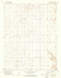
Eminence Cem and the surrounding agricultural landscape of Finney County characterize this mid-1970s survey. The terrain is marked by the course of the Pawnee River as it winds through the southern portion of the quadrangle, where localized infrastructure includes multiple Wells and access to groundwater. Economic activity in the area is reflected in the presence of several Caliche Pit and Caliche Pits sites, used for harvesting calcium carbonate deposits for road construction and industrial purposes. The landscape also features natural water sources such as a lone Spring and a cluster of Springs, vital landmarks in this high plains environment. A location labeled Pheasant and the broader designation of Garfield further define the local geography, offering a detailed view of rural land use and the natural resource extraction points typical of the region during this era.
Find a feature on this map
10 named features on this map. Tap any name to fly to it.
Don’t see what you’re looking for? This feature index may not catch every label — zoom into the map to look around manually.
Map Details
Editions of this 1974 Scott City 4 NE Map
3 editions found
Other maps of this area

1955 · Scott City
USGS Topo · 1:250,000

1958 · Scott City
USGS Topo · 1:250,000

1974 · Ravanna
USGS Topo · 1:24,000
1974 · Scott City 4 SW
USGS Topo · 1:24,000
1974 · Scott City 4 SE
USGS Topo · 1:24,000
1974 · Scott City 4 NW
USGS Topo · 1:24,000

1974 · Dighton SW
USGS Topo · 1:24,000

1974 · Amy SE
USGS Topo · 1:24,000

1974 · Scott City 4 NE
USGS Topo · 1:24,000

1974 · Amy SW
USGS Topo · 1:24,000