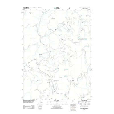
2012 Map of Scott Mountain
USGS Topo · Published 2012About this map
Parker Ranch and the high mountain terrain of the Scott Mountains define this section of Siskiyou County, where the headwaters of the E Fork Scott River and Little Trinity River originate. The landscape is marked by remote landmarks such as Lovers Leap, Schoolhouse Hill, and Scott Mountain Summit, reflecting a history of high-altitude ranching and recreation. Small outposts like McCoys Cabin and Hayden Cabin suggest the long-standing use of these peaks for seasonal shelter.
Find a feature on this map
73 named features on this map. Tap any name to fly to it.
Don’t see what you’re looking for? This feature index may not catch every label — zoom into the map to look around manually.
Map Details
Editions of this 2012 Scott Mountain Map
This is the sole edition of this map. No revisions or reprints were ever made.
Other maps of this area

1886 · Shasta
USGS Topo · 1:250,000

1894 · Shasta
USGS Topo · 1:250,000

1923 · Sawyers Bar
USGS Topo · 1:125,000

1931 · Etna
USGS Topo · 1:96,000

1934 · Etna
USGS Topo · 1:125,000

1948 · Weed
USGS Topo · 1:250,000

1950 · Weed
USGS Topo · 1:250,000
1955 · Bonanza King
USGS Topo · 1:62,500
1955 · China Mountain
USGS Topo · 1:62,500

1955 · Etna
USGS Topo · 1:62,500