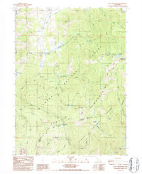
1986 Map of Scott Mountain
USGS Topo · Published 1986About this map
Kangaroo Lake and the surrounding wilderness of the Scott Mountains dominate this mid-1980s topographical study along the Siskiyou and Trinity county line. The terrain is marked by a deep history of resource extraction, evidenced by the Polar Bear Mine, Facey Mine, and numerous prospects scattered across the slopes. The Pacific Crest National Scenic Trail winds through the high country, connecting remote landmarks like Lovers Leap and the Scott Mountain Campground.
Find a feature on this map
49 named features on this map. Tap any name to fly to it.
Don’t see what you’re looking for? This feature index may not catch every label — zoom into the map to look around manually.
Map Details
Editions of this 1986 Scott Mountain Map
This is the sole edition of this map. No revisions or reprints were ever made.
Other maps of this area

1886 · Shasta
USGS Topo · 1:250,000

1894 · Shasta
USGS Topo · 1:250,000

1923 · Sawyers Bar
USGS Topo · 1:125,000

1931 · Etna
USGS Topo · 1:96,000

1934 · Etna
USGS Topo · 1:125,000

1948 · Weed
USGS Topo · 1:250,000

1950 · Weed
USGS Topo · 1:250,000
1955 · Bonanza King
USGS Topo · 1:62,500
1955 · China Mountain
USGS Topo · 1:62,500

1955 · Etna
USGS Topo · 1:62,500