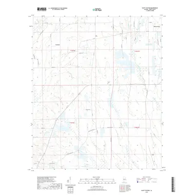
2018 Map of Scott Station
USGS Topo · Published 2018About this map
Scott Station and Coleman serve as central nodes in this rural Perry County landscape, which is defined by an intricate network of waterways and managed lakes. The topography is shaped by the winding paths of Big Prairie Cr and Washington Cr, alongside specialized water features like Lakeland Farms Lake Number Six and Joe Dozier Lake. This 2018 survey reveals a terrain heavily influenced by local land management, where small settlements are connected by a grid of family-named routes such as Jim Brady Rd and Victor Rice Dr.
Find a feature on this map
52 named features on this map. Tap any name to fly to it.
Don’t see what you’re looking for? This feature index may not catch every label — zoom into the map to look around manually.
Map Details
Editions of this 2018 Scott Station Map
This is the sole edition of this map. No revisions or reprints were ever made.
Other maps of this area

1953 · Montgomery
USGS Topo · 1:250,000

1956 · Montgomery
USGS Topo · 1:250,000

1957 · Montgomery
USGS Topo · 1:250,000

1968 · Uniontown West
USGS Topo · 1:24,000

1968 · Uniontown East
USGS Topo · 1:24,000

1968 · Browns
USGS Topo · 1:24,000

1979 · Marion North
USGS Topo · 1:24,000

1979 · Scott Station
USGS Topo · 1:24,000

1979 · Morgan Springs
USGS Topo · 1:24,000

1979 · Marion South
USGS Topo · 1:24,000