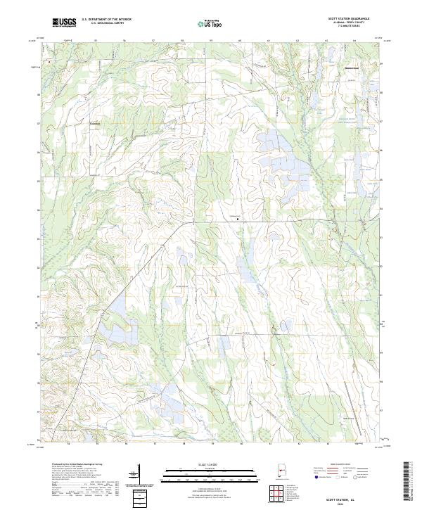
2024 Map of Scott Station
USGS Topo · Published 2024About this map
Big Prairie Creek and its many tributaries, including Dry Creek and Brush Creek, define the drainage patterns of this Perry County landscape. The area is characterized by a mix of agricultural plots and managed woodlands, with a significant cluster of private lakes and ponds in the northeast corner near Zimmerman. Notable water bodies like Joe Dozier Lake, Lake Beth, and the curiously named Lakeland Farms Lake Number Six suggest a history of land management and recreational development. In the southern portion of the map, Vaiden Field serves as a distinct landmark alongside local thoroughfares like Stephens Memorial Rd. Central to the quadrangle is Midway Cem, a key site for genealogical research, while the small settlement of Coleman marks the western reach of this rural Alabama community.
Find a feature on this map
53 named features on this map. Tap any name to fly to it.
Don’t see what you’re looking for? This feature index may not catch every label — zoom into the map to look around manually.
Map Details
Editions of this 2024 Scott Station Map
This is the sole edition of this map. No revisions or reprints were ever made.
Other maps of this area

1953 · Montgomery
USGS Topo · 1:250,000

1956 · Montgomery
USGS Topo · 1:250,000

1957 · Montgomery
USGS Topo · 1:250,000

1968 · Uniontown West
USGS Topo · 1:24,000

1968 · Uniontown East
USGS Topo · 1:24,000

1968 · Browns
USGS Topo · 1:24,000

1979 · Marion North
USGS Topo · 1:24,000

1979 · Scott Station
USGS Topo · 1:24,000

1979 · Morgan Springs
USGS Topo · 1:24,000

1979 · Marion South
USGS Topo · 1:24,000