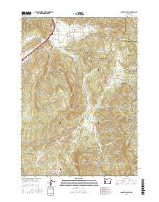
2017 Map of Scotts Valley
USGS Topo · Published 2017About this map
The Harris Family Cem stands as a quiet focal point for genealogists and local historians in this southern Oregon landscape, situated near the base of Ben More Mtn. This 2017 study illustrates the rural character of Douglas and Lane counties, where the boundary line traverses the northeast corner near Indian Butte. The settlement pattern follows the drainage of Elk Cr and its many tributaries, connecting small communities like Elkhead and Pleasant Valley through a network of logging roads and forest spurs.
Find a feature on this map
70 named features on this map. Tap any name to fly to it.
Don’t see what you’re looking for? This feature index may not catch every label — zoom into the map to look around manually.
Map Details
Editions of this 2017 Scotts Valley Map
This is the sole edition of this map. No revisions or reprints were ever made.
Other maps of this area

1897 · Roseburg
USGS Topo · 1:125,000

1900 · Roseburg
USGS Topo · 1:125,000

1954 · Sutherlin
USGS Topo · 1:62,500

1954 · Drain
USGS Topo · 1:62,500

1954 · Anlauf
USGS Topo · 1:62,500

1954 · Glide
USGS Topo · 1:62,500

1958 · Roseburg
USGS Topo · 1:250,000

1959 · Roseburg
USGS Topo · 1:250,000

1979 · Roseburg
USGS Topo · 1:100,000

1979 · Cottage Grove
USGS Topo · 1:100,000