
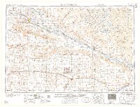
1958 Map of Scottsbluff
USGS Topo · Published 1958About this map
The North Platte River and its parallel rail lines dominate the landscape of the Nebraska panhandle in the late 1950s. The Chicago Burlington & Quincy railroad tracks the river valley through agricultural hubs like Gering, Scottsbluff, and Bayard, while the Union Pacific runs the southern corridor through Kimball and Potter. Prominent landmarks such as Chimney Rock and the Scotts Bluff National Monument rise above the valley, serving as enduring navigational markers just as they did for western emigrants. To the south, the Sioux Ordnance Depot occupies a significant tract of land, reflecting the era's military footprint. The northern portion of the sheet reveals the lake-dotted terrain of the Crescent Lake National Wildlife Refuge, where water bodies like Island Lake and Blue Lake break the expanse of the sand hills.
Find a feature on this map
167 named features on this map. Tap any name to fly to it.
Don’t see what you’re looking for? This feature index may not catch every label — zoom into the map to look around manually.
Map Details
Editions of this 1958 Scottsbluff Map
2 editions found
Other maps of this area

1896 · Patrick
USGS Topo · 1:125,000

1896 · Browns Creek
USGS Topo · 1:125,000

1897 · Ogallala
USGS Topo · 1:125,000

1898 · Scotts Bluff
USGS Topo · 1:125,000

1898 · Camp Clarke
USGS Topo · 1:125,000

1899 · Browns Creek
USGS Topo · 1:125,000

1899 · Sidney
USGS Topo · 1:125,000

1899 · Goshen Hole
USGS Topo · 1:125,000

1899 · Whistle Creek
USGS Topo · 1:125,000

1900 · Chappell
USGS Topo · 1:125,000