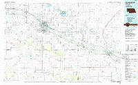
1985 Map of Scottsbluff
USGS Topo · Published 1986About this map
Scotts Bluff National Monument and the spire of Chimney Rock stand as iconic sentinels along the North Platte River valley in this mid-1980s Nebraska landscape. The map details the intensive irrigation and transportation network that supports the communities of Scottsbluff, Gering, and Bridgeport. Moving south from the river valley, the terrain shifts into the Wildcat Hills, where landmarks like Bighorn Mountain and Table Top Mtn dominate the high plains. The regional connectivity is defined by the Union Pacific and Burlington Northern railroads, which parallel the river and link agricultural centers like Mitchell, Morrill, and Bayard. Conservation and recreation areas are prominent, from the North Platte Nat Wildlife Refuge around Lake Minatare to the Wildcat Hills State Rec Area, reflecting a landscape balanced between heavy agriculture and protected natural landmarks.
Find a feature on this map
56 named features on this map. Tap any name to fly to it.
Don’t see what you’re looking for? This feature index may not catch every label — zoom into the map to look around manually.
Map Details
Editions of this 1985 Scottsbluff Map
2 editions found
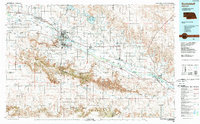
Other maps of this area

1896 · Patrick
USGS Topo · 1:125,000

1896 · Browns Creek
USGS Topo · 1:125,000

1898 · Scotts Bluff
USGS Topo · 1:125,000

1898 · Camp Clarke
USGS Topo · 1:125,000

1899 · Browns Creek
USGS Topo · 1:125,000

1899 · Sidney
USGS Topo · 1:125,000

1899 · Goshen Hole
USGS Topo · 1:125,000

1899 · Whistle Creek
USGS Topo · 1:125,000

1947 · Bronco Lake
USGS Topo · 1:24,000

1948 · Hemingford 4 SW
USGS Topo · 1:24,000