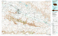
1985 Map of Scottsbluff
USGS Topo · Published 1989About this map
Scotts Bluff National Monument and the dramatic topography of the Wildcat Hills anchor this 1980s look at the Nebraska Panhandle. The landscape is defined by the valley of the North Platte River, where a complex network of irrigation systems like the Tri-State Canal and Fort Laramie Canal support the agricultural corridor between Scottsbluff and Bridgeport. The map illustrates a crossroads of Western migration and industry, following the path of the Emigrant Trail alongside modern rail traffic on the Union Pacific and Burlington Northern lines. Geologic landmarks that served as beacons for early travelers remain prominent, including the iconic Chimney Rock, Courthouse Rock, and Jail Rock. From the water management at Lake Minatare to the isolated plateaus of Castle Rock and Smokestack Rock, the sheet captures the intersection of natural Nebraska landmarks and the engineered rural landscape.
Find a feature on this map
93 named features on this map. Tap any name to fly to it.
Don’t see what you’re looking for? This feature index may not catch every label — zoom into the map to look around manually.
Map Details
Editions of this 1985 Scottsbluff Map
2 editions found
Other maps of this area

1896 · Patrick
USGS Topo · 1:125,000

1896 · Browns Creek
USGS Topo · 1:125,000

1898 · Scotts Bluff
USGS Topo · 1:125,000

1898 · Camp Clarke
USGS Topo · 1:125,000

1899 · Browns Creek
USGS Topo · 1:125,000

1899 · Sidney
USGS Topo · 1:125,000

1899 · Goshen Hole
USGS Topo · 1:125,000

1899 · Whistle Creek
USGS Topo · 1:125,000

1947 · Bronco Lake
USGS Topo · 1:24,000

1948 · Hemingford 4 SW
USGS Topo · 1:24,000