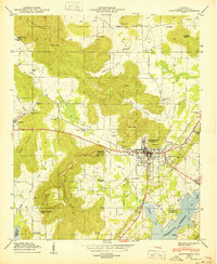
1950 Map of Scottsboro
USGS Topo · Published 1950About this map
Scottsboro serves as the focal point of this 1950 Tennessee Valley Authority and USGS collaboration, capturing the town as it expanded along the Southern railroad and the Lee Highway. The map details the local infrastructure of the era, from the Webb Addition residential area to specialized facilities like the Tri-Counties Tuberculosis Sanatorium and the State Prison Camp. The geography is defined by the relationship between the rising waters of the Guntersville Reservoir and the surrounding high ground of July Mountain and Cotton Mountain. Scattered throughout the smaller coves like Maynard Cove and McBroom Cove are numerous community landmarks, including the House of Happiness Church and several family cemeteries such as Shelton Cem and Pinhook Cem, which offer significant value for genealogical research in Jackson County.
Find a feature on this map
50 named features on this map. Tap any name to fly to it.
Don’t see what you’re looking for? This feature index may not catch every label — zoom into the map to look around manually.
Map Details
Editions of this 1950 Scottsboro Map
2 editions found
Other maps of this area

1886 · Stevenson
USGS Topo · 1:125,000

1888 · Scottsboro
USGS Topo · 1:125,000

1892 · Scottsboro
USGS Topo · 1:125,000

1892 · Stevenson
USGS Topo · 1:125,000

1895 · Stevenson
USGS Topo · 1:125,000

1936 · Scottsboro
USGS Topo · 1:24,000

1936 · Wannville
USGS Topo · 1:24,000

1936 · Langston
USGS Topo · 1:24,000

1936 · Mud Creek
USGS Topo · 1:24,000

1936 · Dutton
USGS Topo · 1:24,000