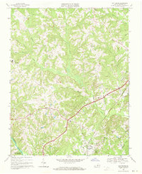
1968 Map of Scottsburg
USGS Topo · Published 1971About this map
Scottsburg and the surrounding Halifax County countryside are captured here in the late 1960s, defined by the Southern railroad line and the convergence of several major waterways. The town center features the Scottsburg Sch, St James Ch, and the nearby Oakland Cem. To the south, the Banister River flows into the northern reaches of the John H Kerr Reservoir, while northern terrain is segmented by numerous creeks like Black Walnut Creek and Difficult Creek. Smaller communities and junctions like Mount Laurel, Midway, and Rodges Chapel are scattered throughout the landscape, connected by a network of rural roads that cross over Long Branch and Dry Fork. Historically significant sites like Clays Mill on Mill Branch illustrate the area's long-standing reliance on local waterpower and rail transport for its agricultural economy.
Find a feature on this map
35 named features on this map. Tap any name to fly to it.
Don’t see what you’re looking for? This feature index may not catch every label — zoom into the map to look around manually.
Map Details
Editions of this 1968 Scottsburg Map
2 editions found
Other maps of this area

1941 · Clarksville
USGS Topo · 1:48,000

1943 · Clarksville
USGS Topo · 1:62,500

1953 · South Boston
USGS Topo · 1:62,500

1953 · Greensboro
USGS Topo · 1:250,000

1954 · Greensboro
USGS Topo · 1:250,000

1954 · Clover
USGS Topo · 1:62,500

1954 · Halifax
USGS Topo · 1:62,500

1957 · South Boston
USGS Topo · 1:62,500

1957 · Clarksville
USGS Topo · 1:62,500

1962 · Greensboro
USGS Topo · 1:250,000