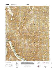
2016 Map of Scottsville
USGS Topo · Published 2016About this map
The James River snakes along the southern border of this landscape, forming the boundary between Albemarle, Fluvanna, and Buckingham counties. The town of Scottsville serves as a primary hub near the western edge, positioned just north of the dramatic river curve at Horseshoe Bend. Inland from the river, the terrain is defined by the winding course of the Hardware River and its various tributaries, including Briery Creek, which flow through a network of rural ridges such as Raccoon Ridge.
Find a feature on this map
82 named features on this map. Tap any name to fly to it.
Don’t see what you’re looking for? This feature index may not catch every label — zoom into the map to look around manually.
Map Details
Editions of this 2016 Scottsville Map
This is the sole edition of this map. No revisions or reprints were ever made.
Other maps of this area

1891 · Palmyra
USGS Topo · 1:125,000

1892 · Buckingham
USGS Topo · 1:125,000

1895 · Palmyra
USGS Topo · 1:125,000

1897 · Palmyra
USGS Topo · 1:125,000

1929 · Covesville
USGS Topo · 1:62,500

1935 · Covesville
USGS Topo · 1:62,500

1943 · Scottsville
USGS Topo · 1:62,500

1945 · Covesville
USGS Topo · 1:62,500

1946 · Scottsville
USGS Topo · 1:62,500

1947 · Roanoke
USGS Topo · 1:250,000