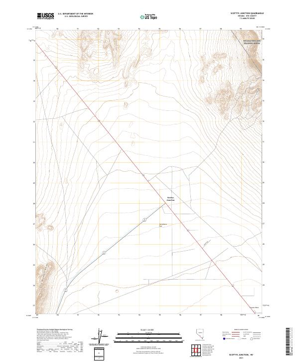
2021 Map of Scottys Junction
USGS Topo · Published 2021About this map
Sarcobatus Flat dominates this desert landscape, where long stretches of high-desert terrain meet the eastern fringes of the Gold Mountain Range. The map centers on the small highway settlement of Scottys Junction, a critical waypoint at the intersection of regional transit routes in Nye County. To the southeast, the terrain descends toward Coyote Holes, indicating a landscape where seasonal water sources or historical wells dictated movement and survival in an otherwise arid environment. Unlike more developed regions, the road network here remains sparse, primarily defined by the intersection of major thoroughfares and minor desert tracks like Creech Rd. The grid layout of public land surveys reveals a territory divided for administrative and mining purposes rather than dense residential settlement, capturing a remote corner of Nevada where the geography is defined more by vast basins and isolated peaks than by urban growth.
Find a feature on this map
11 named features on this map. Tap any name to fly to it.
Don’t see what you’re looking for? This feature index may not catch every label — zoom into the map to look around manually.
Map Details
Editions of this 2021 Scottys Junction Map
This is the sole edition of this map. No revisions or reprints were ever made.
Other maps of this area

1908 · Kawich
USGS Topo · 1:250,000

1908 · Lida
USGS Topo · 1:250,000

1913 · Lida
USGS Topo · 1:250,000

1942 · Tolicha Peak
USGS Topo · 1:125,000

1954 · Goldfield
USGS Topo · 1:250,000

1955 · Goldfield
USGS Topo · 1:250,000

1958 · Goldfield
USGS Topo · 1:250,000

1962 · Goldfield
USGS Topo · 1:250,000
1966 · Springdale
USGS Topo · 1:62,500

1968 · Stonewall Pass
USGS Topo · 1:24,000