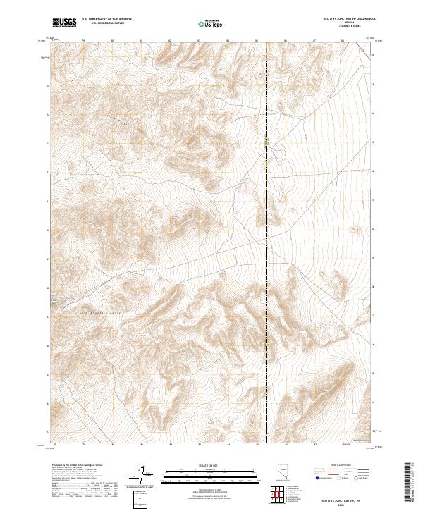
2021 Map of Scottys Junction SW
USGS Topo · Published 2021About this map
Gold Mountain Range dominates the southern portion of this high-desert landscape along the border of Esmeralda and Nye counties. This 2021 survey details a region characterized by dramatic elevation changes, where the northern expanse is defined by the steep topography of Slate Ridge. The cartography traces the stark boundary between the two counties, cutting through a series of complex ridges and basins that include the notably named Hells Gate. In the extreme southeast, the map captures the beginning of the Amargosa Range, illustrating the continuous mountain systems that define this part of the Great Basin. While lacking modern permanent settlements, the area is meticulously gridded by the Public Land Survey System, showing sections within townships such as t7s r42e and t7s r43e, which remain vital for land management and mineral claims in this arid mining-adjacent corridor.
Find a feature on this map
11 named features on this map. Tap any name to fly to it.
Don’t see what you’re looking for? This feature index may not catch every label — zoom into the map to look around manually.
Map Details
Editions of this 2021 Scottys Junction SW Map
This is the sole edition of this map. No revisions or reprints were ever made.
Other maps of this area

1908 · Lida
USGS Topo · 1:250,000

1913 · Lida
USGS Topo · 1:250,000

1954 · Goldfield
USGS Topo · 1:250,000

1955 · Goldfield
USGS Topo · 1:250,000

1957 · Ubehebe Crater
USGS Topo · 1:62,500

1958 · Goldfield
USGS Topo · 1:250,000

1962 · Goldfield
USGS Topo · 1:250,000

1968 · Stonewall Pass
USGS Topo · 1:24,000
1968 · Bonnie Claire NW
USGS Topo · 1:24,000
1968 · Gold Point
USGS Topo · 1:24,000