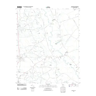
2011 Map of Scranton
USGS Topo · Published 2011About this map
The Lynches River winds through this coastal plain landscape, defining the topography south of Friendfield and east of Scranton. This survey reveals a dense network of family and community landmarks, including numerous burial sites such as Gause Cemetery, Old Liberty Cemetery, and Saint Johns Cemetery. The local infrastructure is shaped by the river and its tributaries, notably marked by the Bass Bridge and the nearby Burkett Landing. Further west, the commercial and residential centers of Scranton and Lake City are clearly delineated along the rail corridor. The map also identifies specialized local features like the Cockfield Aerodrome and several bay depressions, including Nettles Bay and Sugarfoot Bay, which characterize the drainage patterns of the region.
Find a feature on this map
125 named features on this map. Tap any name to fly to it.
Don’t see what you’re looking for? This feature index may not catch every label — zoom into the map to look around manually.
Map Details
Editions of this 2011 Scranton Map
This is the sole edition of this map. No revisions or reprints were ever made.
Other maps of this area

1940 · Florence West
USGS Topo · 1:62,500

1940 · Florence East
USGS Topo · 1:62,500

1945 · Florence East
USGS Topo · 1:62,500

1945 · Florence West
USGS Topo · 1:62,500

1946 · Hyman
USGS Topo · 1:62,500

1946 · Lake City
USGS Topo · 1:62,500

1949 · Georgetown
USGS Topo · 1:250,000

1953 · Florence
USGS Topo · 1:250,000

1954 · Florence
USGS Topo · 1:250,000

1967 · Georgetown
USGS Topo · 1:250,000