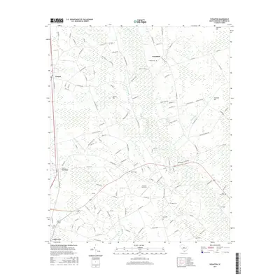
2017 Map of Scranton
USGS Topo · Published 2017About this map
Lynches River winds through the eastern portion of this landscape, defining a terrain characterized by numerous elliptical depressions known as Carolina Bays, such as Sugarfoot Bay, Cockfield Bay, and Nettles Bay. These geographic features dictate the drainage patterns and road placements between the settlements of Scranton and Coward. The area is densely dotted with family and community burial sites, including Old Liberty Cem, Saint Johns Cem, and Creel Cem, which serve as vital markers for local genealogical research. In the southern reach, the northern edge of Lake City is visible, while the Cockfield Aerodrome and crossings like Anderson Bridge and Bass Bridge highlight the infrastructure connecting these rural communities. The map reflects a classic coastal plain environment where agriculture and natural wetlands exist in close proximity.
Find a feature on this map
118 named features on this map. Tap any name to fly to it.
Don’t see what you’re looking for? This feature index may not catch every label — zoom into the map to look around manually.
Map Details
Editions of this 2017 Scranton Map
This is the sole edition of this map. No revisions or reprints were ever made.
Other maps of this area

1940 · Florence West
USGS Topo · 1:62,500

1940 · Florence East
USGS Topo · 1:62,500

1945 · Florence East
USGS Topo · 1:62,500

1945 · Florence West
USGS Topo · 1:62,500

1946 · Hyman
USGS Topo · 1:62,500

1946 · Lake City
USGS Topo · 1:62,500

1949 · Georgetown
USGS Topo · 1:250,000

1953 · Florence
USGS Topo · 1:250,000

1954 · Florence
USGS Topo · 1:250,000

1967 · Georgetown
USGS Topo · 1:250,000