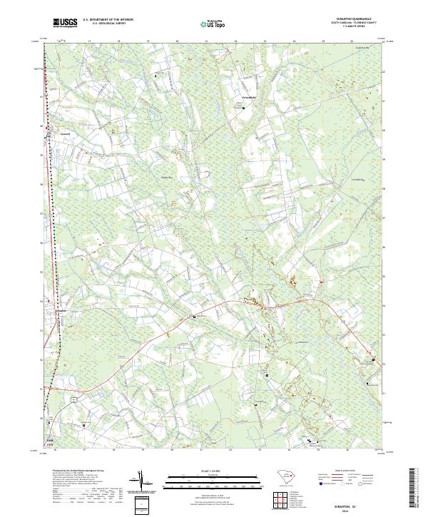
2024 Map of Scranton
USGS Topo · Published 2024About this map
The Lynches River winds through the heart of this Florence County landscape, defining a terrain shaped by agriculture and water management. Modern drainage infrastructure like the High Hill Drainage Canal and the Gause Canal Rd intersect with natural features such as Nettles Bay and Cockfield Bay, illustrating the long-standing effort to utilize the low-lying Carolina bays for productive use. The settlements of Scranton and Coward anchor the western edge, linked by the CSX Transportation railroad line that mirrors the path of the primary highway corridor.
Find a feature on this map
129 named features on this map. Tap any name to fly to it.
Don’t see what you’re looking for? This feature index may not catch every label — zoom into the map to look around manually.
Map Details
Editions of this 2024 Scranton Map
This is the sole edition of this map. No revisions or reprints were ever made.
Other maps of this area

1940 · Florence West
USGS Topo · 1:62,500

1940 · Florence East
USGS Topo · 1:62,500

1945 · Florence East
USGS Topo · 1:62,500

1945 · Florence West
USGS Topo · 1:62,500

1946 · Hyman
USGS Topo · 1:62,500

1946 · Lake City
USGS Topo · 1:62,500

1949 · Georgetown
USGS Topo · 1:250,000

1953 · Florence
USGS Topo · 1:250,000

1954 · Florence
USGS Topo · 1:250,000

1967 · Georgetown
USGS Topo · 1:250,000