
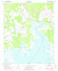
1951 Map of Scranton
USGS Topo · Published 1953About this map
Scranton and Sladesville anchor this coastal survey of the Hyde County shoreline, where the landscape transitions from cultivated fields into the sprawling wetlands of the Swanquarter National Wildlife Refuge. The map reveals a community organized around water and faith, featuring numerous small settlements like Germantown and Beulah, alongside local landmarks such as Eunice Chapel, Zion Ch, and the County Training Sch.
Find a feature on this map
60 named features on this map. Tap any name to fly to it.
Don’t see what you’re looking for? This feature index may not catch every label — zoom into the map to look around manually.
Map Details
Editions of this 1951 Scranton Map
2 editions found
Other maps of this area

1914 · Belhaven
USGS Topo · 1:48,000

1916 · Belhaven
USGS Topo · 1:62,500

1943 · Columbia
USGS Topo · 1:125,000

1943 · Plymouth
USGS Topo · 1:125,000

1950 · Lowland
USGS Topo · 1:24,000

1951 · Pamlico Point
USGS Topo · 1:24,000

1951 · Great Island
USGS Topo · 1:24,000

1951 · Pamlico Beach
USGS Topo · 1:24,000

1951 · Belhaven
USGS Topo · 1:24,000

1951 · Swanquarter
USGS Topo · 1:24,000