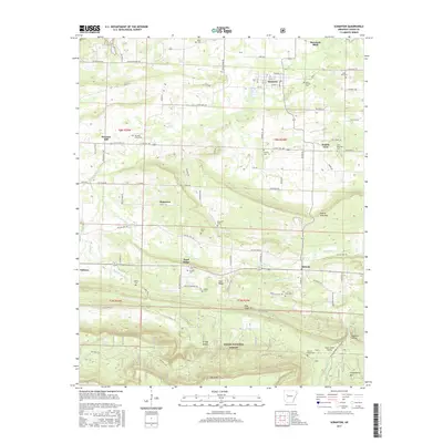
2017 Map of Scranton
USGS Topo · Published 2017About this map
Scranton and Morrison Bluff anchor the northern portion of this Logan County landscape, where the agricultural plains meet the northern edge of the Ozark National Forest. The map reveals a dense network of local history, particularly through its numerous community burial grounds such as Saint Ignatius Cem and Saint Meinrads Cem, which speak to the area’s early Catholic heritage. Settlement patterns follow the natural terrain, with communities like Prairie View and Plainview established between the drainage of Cane Cr and Pee Dee Cr. Historically significant transport routes are noted through the presence of the Old Military Rd, which cuts across the central townships. The southern portion transition into high ridges and deep valleys, including Rich Mtn and Saint Louis Valley, illustrating the varied geography that defined the economy and isolation of this Arkansas region.
Find a feature on this map
67 named features on this map. Tap any name to fly to it.
Don’t see what you’re looking for? This feature index may not catch every label — zoom into the map to look around manually.
Map Details
Editions of this 2017 Scranton Map
This is the sole edition of this map. No revisions or reprints were ever made.
Other maps of this area

1879 · Mountain Home
USGS Topo · 1:62,500

1887 · Magazine Mountain #1
USGS Topo · 1:62,500

1887 · Magazine Mountain #4
USGS Topo · 1:62,500

1887 · Magazine Mountain
USGS Topo · 1:62,500

1888 · Dardanelle #2
USGS Topo · 1:62,500

1888 · Dardanelle #3
USGS Topo · 1:62,500

1890 · Magazine Mountain
USGS Topo · 1:125,000

1890 · Dardanelle
USGS Topo · 1:125,000

1956 · Russellville
USGS Topo · 1:250,000

1961 · Coal Hill
USGS Topo · 1:24,000