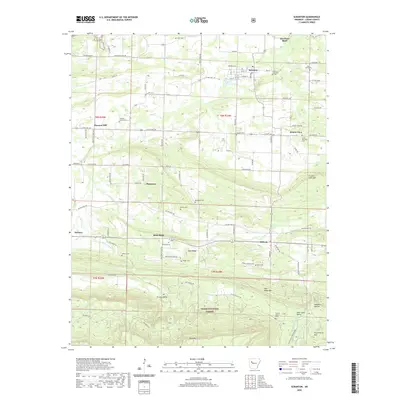
2020 Map of Scranton
USGS Topo · Published 2020About this map
Scranton and Subiaco anchor a landscape of small agricultural settlements and rugged foothills south of the Arkansas River. The northern plains are dotted with long-standing community centers like Prairie View and Pleasant Hill, where numerous burial grounds such as Saint Ignatius Cem and Saint Meinrads Cem provide significant genealogical data points. The terrain shifts dramatically to the south, rising into the Ozark National Forest and the heights of Rich Mountain and Huckleberry Mountain. The drainage patterns of Cane Creek and Pee Dee Creek dictate the local geography, carving through the valley floors before the land ascends into Greasy Valley. This survey captures the rural character of Logan County, documenting the network of old roads like Old Military Road that traverse the gaps between the timbered ridges and family-held farms.
Find a feature on this map
93 named features on this map. Tap any name to fly to it.
Don’t see what you’re looking for? This feature index may not catch every label — zoom into the map to look around manually.
Map Details
Editions of this 2020 Scranton Map
This is the sole edition of this map. No revisions or reprints were ever made.
Other maps of this area

1879 · Mountain Home
USGS Topo · 1:62,500

1887 · Magazine Mountain #1
USGS Topo · 1:62,500

1887 · Magazine Mountain #4
USGS Topo · 1:62,500

1887 · Magazine Mountain
USGS Topo · 1:62,500

1888 · Dardanelle #2
USGS Topo · 1:62,500

1888 · Dardanelle #3
USGS Topo · 1:62,500

1890 · Magazine Mountain
USGS Topo · 1:125,000

1890 · Dardanelle
USGS Topo · 1:125,000

1956 · Russellville
USGS Topo · 1:250,000

1961 · Coal Hill
USGS Topo · 1:24,000