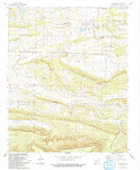
1993 Map of Scranton
USGS Topo · Published 1993About this map
Scranton and Prairie View anchor the northern landscape of this Arkansas survey, situated just south of the Morrison Bluff area. The region is defined by a series of prominent east-west ridges including Prairie Mountain, Sand Ridge, and Pine Ridge, which separate agricultural valleys like Greasy Valley from the northern hills. Numerous family and community cemeteries, such as Ellsworth Cem, Butler Cem, and Wright Cem, are scattered across these ridges, offering significant detail for genealogical research in this part of Logan County.
Find a feature on this map
47 named features on this map. Tap any name to fly to it.
Don’t see what you’re looking for? This feature index may not catch every label — zoom into the map to look around manually.
Map Details
Editions of this 1993 Scranton Map
This is the sole edition of this map. No revisions or reprints were ever made.
Other maps of this area

1879 · Mountain Home
USGS Topo · 1:62,500

1887 · Magazine Mountain #1
USGS Topo · 1:62,500

1887 · Magazine Mountain #4
USGS Topo · 1:62,500

1887 · Magazine Mountain
USGS Topo · 1:62,500

1888 · Dardanelle #2
USGS Topo · 1:62,500

1888 · Dardanelle #3
USGS Topo · 1:62,500

1890 · Magazine Mountain
USGS Topo · 1:125,000

1890 · Dardanelle
USGS Topo · 1:125,000

1956 · Russellville
USGS Topo · 1:250,000

1961 · Coal Hill
USGS Topo · 1:24,000