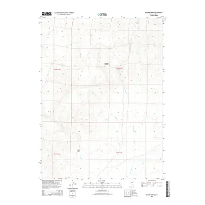
2015 Map of Scraper Springs
USGS Topo · Published 2015About this map
Scraper Springs serves as the central landmark for this high-desert landscape in Elko County, where the hydrology of the Great Basin is on clear display through several ephemeral and seasonal waterways. The drainage network is characterized by Scraper Springs Cr and Buffalo Cr, which carve through the terrain alongside Milligan Cr and Willow Cr in the northern reaches. Evidence of land use and seasonal activity is found at Frazer Field, located near the intersection of several topographic boundaries including t39n r46e and t40n r46e. These township and range demarcations emphasize the systematic survey of this open range, which also features Buffalo Springs and Rock Cr to the southeast. The map illustrates a sparse but vital system of water sources that historically supported ranching and transit across this portion of northern Nevada.
Find a feature on this map
13 named features on this map. Tap any name to fly to it.
Don’t see what you’re looking for? This feature index may not catch every label — zoom into the map to look around manually.
Map Details
Editions of this 2015 Scraper Springs Map
This is the sole edition of this map. No revisions or reprints were ever made.
Other maps of this area

1955 · McDermitt
USGS Topo · 1:250,000

1959 · McDermitt
USGS Topo · 1:250,000

1965 · Willow Creek Reservoir
USGS Topo · 1:24,000

1965 · Squaw Valley Ranch
USGS Topo · 1:24,000
1965 · Midas
USGS Topo · 1:24,000

1973 · Haystack Peak
USGS Topo · 1:24,000

1973 · Little Rock Creek
USGS Topo · 1:24,000

1974 · Soldier Cap
USGS Topo · 1:24,000

1974 · Burner Hills
USGS Topo · 1:24,000

1977 · Scraper Springs
USGS Topo · 1:24,000