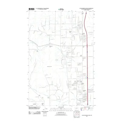
2011 Map of Scratchgravel Hills
USGS Topo · Published 2011About this map
The Scratchgravel Hills rise above the northwestern edge of Montana's capital, defining a landscape shaped by both military history and modern residential growth. This 2011 survey captures the significant presence of Fort Harrison, including its Fort Harrison Post Office and the adjacent Fort Harrison Army Air Field. The map records a dense cluster of burial grounds and community facilities along the eastern corridor, such as Forest Vale Cemetery and the Independent Order of Odd Fellows Cemetery. These landmarks, along with the Helena Valley Canal and Tenmile Creek, illustrate the complex management of water and land use near settlements like Evergreen Court and Iron. The terrain is marked by numerous named drainages including Butcherknife Gulch, Sawmill Gulch, and Iowa Gulch, which suggest the area's historical mining and timber extraction activities.
Find a feature on this map
117 named features on this map. Tap any name to fly to it.
Don’t see what you’re looking for? This feature index may not catch every label — zoom into the map to look around manually.
Map Details
Editions of this 2011 Scratchgravel Hills Map
This is the sole edition of this map. No revisions or reprints were ever made.
Other maps of this area

1886 · Fort Logan
USGS Topo · 1:250,000

1889 · Helena
USGS Topo · 1:250,000

1893 · Helena
USGS Topo · 1:250,000

1899 · Helena
USGS Topo · 1:62,500

1899 · Helena
USGS Topo · 1:250,000

1903 · Helena
USGS Topo · 1:250,000

1947 · Butte
USGS Topo · 1:250,000

1948 · White Sulphur Springs
USGS Topo · 1:250,000

1950 · East Helena
USGS Topo · 1:62,500

1950 · Helena
USGS Topo · 1:62,500