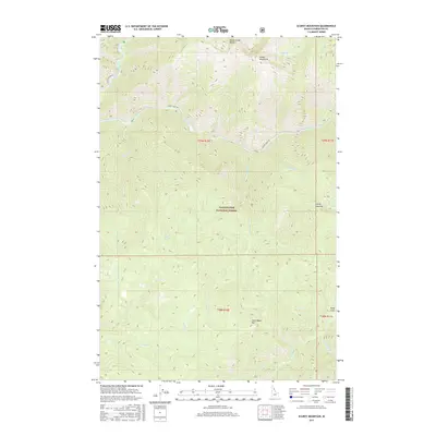
2017 Map of Scurvy Mountain
USGS Topo · Published 2017About this map
Scurvy Mountain and the surrounding high country of the Clearwater National Forest dominate this 2017 survey. The landscape is defined by its complex drainage network, where Kelly Creek and Moose Creek carve through steep topography beneath landmarks like Switchback Hill and the Moose Mountains. Access to this interior wilderness is traced along Black Canyon Rd and Moose Creek Rd, which follow the natural contours of the river valleys. Near the eastern edge, the elevation peaks near Scurvy Lake, while the southern reaches descend toward Pony Flats. This map captures a modern view of a preserved backcountry, emphasizing the role of the North Fork Clearwater River in shaping the geography of northern Idaho.
Find a feature on this map
30 named features on this map. Tap any name to fly to it.
Don’t see what you’re looking for? This feature index may not catch every label — zoom into the map to look around manually.
Map Details
Editions of this 2017 Scurvy Mountain Map
This is the sole edition of this map. No revisions or reprints were ever made.
Other maps of this area

1911 · Lolo
USGS Topo · 1:250,000

1913 · Lolo
USGS Topo · 1:250,000

1956 · Hamilton
USGS Topo · 1:250,000

1959 · Hamilton
USGS Topo · 1:250,000

1960 · Hamilton
USGS Topo · 1:250,000
1963 · Elizabeth Lake
USGS Topo · 1:24,000

1964 · Hamilton
USGS Topo · 1:250,000

1965 · Osier Ridge
USGS Topo · 1:24,000

1965 · Junction Mtn
USGS Topo · 1:24,000
1965 · Moose Mtn
USGS Topo · 1:24,000