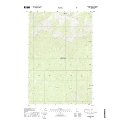
2020 Map of Scurvy Mountain
USGS Topo · Published 2020About this map
Scurvy Mtn and the surrounding wilderness of Clearwater National Forest define this high-elevation landscape. The drainage network is dominated by the North Fork Clearwater River, which receives numerous tributaries including Kelly Creek, Slippery Cr, and Barnard Cr. The topography is characterized by significant vertical relief, with prominent peaks like the Moose Mountains and Moose Creek Buttes overlooking deep drainages and small alpine features such as Scurvy Lake.
Find a feature on this map
44 named features on this map. Tap any name to fly to it.
Don’t see what you’re looking for? This feature index may not catch every label — zoom into the map to look around manually.
Map Details
Editions of this 2020 Scurvy Mountain Map
This is the sole edition of this map. No revisions or reprints were ever made.
Other maps of this area

1911 · Lolo
USGS Topo · 1:250,000

1913 · Lolo
USGS Topo · 1:250,000

1956 · Hamilton
USGS Topo · 1:250,000

1959 · Hamilton
USGS Topo · 1:250,000

1960 · Hamilton
USGS Topo · 1:250,000
1963 · Elizabeth Lake
USGS Topo · 1:24,000

1964 · Hamilton
USGS Topo · 1:250,000

1965 · Osier Ridge
USGS Topo · 1:24,000

1965 · Junction Mtn
USGS Topo · 1:24,000
1965 · Moose Mtn
USGS Topo · 1:24,000