
1945 Map of Sea Breeze
USGS Topo · Published 1945About this map
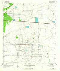
Stanolind Reservoir and the adjacent industrial infrastructure of mid-century coastal Texas define this 1940s landscape. Located in eastern Chambers County, the map details a region transitioning into a modern hydrological and industrial network, with the Lone Star Canal and multiple Pumping Stations supporting the water needs of the area's agricultural or industrial operations. The small settlement of Sea Breeze sits near the northeastern corner, marking a quiet point of human habitation in a landscape otherwise dominated by the extensive drainage systems of Oyster Bayou, East Bay Bayou, and Elm Bayou. Local transit and ranching history are grounded by the presence of Whites Ranch Road, which cuts across the central marshlands. This survey, compiled by the Tennessee Valley Authority for the War Department, provides a technical view of the coastal prairie before late-20th-century development altered the natural wetlands.
Find a feature on this map
9 named features on this map. Tap any name to fly to it.
Don’t see what you’re looking for? This feature index may not catch every label — zoom into the map to look around manually.
Map Details
Editions of this 1945 Sea Breeze Map
This is the sole edition of this map. No revisions or reprints were ever made.
Other maps of this area

1931 · High Island
USGS Topo · 1:24,000

1931 · Frozen Point
USGS Topo · 1:24,000

1933 · Frozen Point
USGS Topo · 1:31,680

1943 · High Island
USGS Topo · 1:31,680

1943 · Frozen Point
USGS Topo · 1:24,000

1943 · Sea Breeze
USGS Topo · 1:24,000

1943 · Stowell
USGS Topo · 1:24,000

1950 · Houston
USGS Topo · 1:250,000

1956 · Houston
USGS Topo · 1:250,000
1961 · Monroe City
USGS Topo · 1:24,000