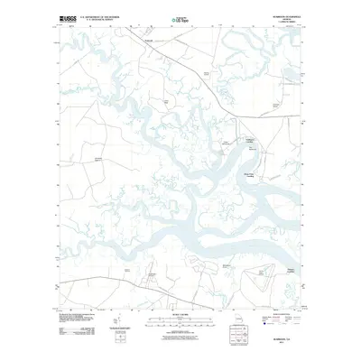
2011 Map of Seabrook
USGS Topo · Published 2011About this map
The Halfmoon defines the complex geography of this coastal Georgia region, where the tidal fingers of the North Newport River and South Newport River weave through low-lying hammocks and island pastures. The map details a landscape transition from the inland settlement of Seabrook toward the marshy margins of Colonels Island. Local transportation and historical connectivity are visible through numerous landings, such as Halfmoon Landing, Drum Point Landing, and Thomas Landing, which reflect a river-centered economy and lifestyle. Aviation also marks this coastal strip, with Stevens Airfield, Eagle Neck Airport, and Harris Neck Airport distributed across the terrain.
Find a feature on this map
43 named features on this map. Tap any name to fly to it.
Don’t see what you’re looking for? This feature index may not catch every label — zoom into the map to look around manually.
Map Details
Editions of this 2011 Seabrook Map
This is the sole edition of this map. No revisions or reprints were ever made.
Other maps of this area

1920 · Sapelo River
USGS Topo · 1:62,500

1920 · Limerick
USGS Topo · 1:62,500

1928 · St Catherines Island
USGS Topo · 1:62,500

1943 · St Catherines Island
USGS Topo · 1:62,500

1943 · Sapelo River
USGS Topo · 1:62,500

1944 · Limerick
USGS Topo · 1:62,500

1944 · Ossabaw Island
USGS Topo · 1:62,500

1945 · St. Catherine's Island
USGS Topo · 1:62,500

1945 · Ossabaw Island
USGS Topo · 1:62,500

1945 · Sapelo River
USGS Topo · 1:62,500