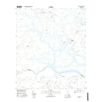
2017 Map of Seabrook
USGS Topo · Published 2017About this map
North Newport River and the South Newport River dominate this coastal Georgia landscape, winding through a complex network of marshes and hammocks in the decade before 2020. This particular survey captures the intricate water paths of the Timmons River, South Newport Cut, and Cross Tide Creek, which define the boundary between Liberty and McIntosh Counties. The presence of Lebanon Cem and Seabrook School Rd provides essential markers for local history and genealogy, locating family roots near the settlement of Seabrook. To the south, Harris Neck and its associated Airfield Perimeter Trail sit adjacent to Bull Town Swamp, while the small aviation hub at Eagle Neck Airport serves the community of Eagle Neck. The map illustrates the coastal transition from established landings like Halfmoon Landing to the more open reaches of Colonels Island.
Find a feature on this map
70 named features on this map. Tap any name to fly to it.
Don’t see what you’re looking for? This feature index may not catch every label — zoom into the map to look around manually.
Map Details
Editions of this 2017 Seabrook Map
This is the sole edition of this map. No revisions or reprints were ever made.
Other maps of this area

1920 · Sapelo River
USGS Topo · 1:62,500

1920 · Limerick
USGS Topo · 1:62,500

1928 · St Catherines Island
USGS Topo · 1:62,500

1943 · St Catherines Island
USGS Topo · 1:62,500

1943 · Sapelo River
USGS Topo · 1:62,500

1944 · Limerick
USGS Topo · 1:62,500

1944 · Ossabaw Island
USGS Topo · 1:62,500

1945 · St. Catherine's Island
USGS Topo · 1:62,500

1945 · Ossabaw Island
USGS Topo · 1:62,500

1945 · Sapelo River
USGS Topo · 1:62,500