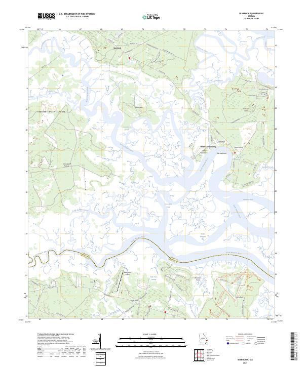
2024 Map of Seabrook
USGS Topo · Published 2024About this map
Harris Neck National Wildlife Refuge dominates the southeastern reaches of this coastal survey, where the South Newport River and the North Newport River converge through a complex network of tidal waterways. The landscape is defined by its deep maritime history, visible in the family names and settlements like Seabrook and Halfmoon Landing. Further inland, the map preserves the location of Baker Cem and the remnants of rural education along Seabrook School Rd. The transition from the dense marshes of Bull Town Swamp to elevated landmarks like Belvedere Point and Colonel's Island illustrates the geographic constraints that shaped early Georgian coastal development. Modern utility is seen at the Eagle Neck Airport, yet the layout of roads like Old Shellman Rd and Ferry Rd speaks to the long-standing transportation corridors used to navigate these island-fringe communities.
Find a feature on this map
78 named features on this map. Tap any name to fly to it.
Don’t see what you’re looking for? This feature index may not catch every label — zoom into the map to look around manually.
Map Details
Editions of this 2024 Seabrook Map
This is the sole edition of this map. No revisions or reprints were ever made.
Other maps of this area

1920 · Sapelo River
USGS Topo · 1:62,500

1920 · Limerick
USGS Topo · 1:62,500

1928 · St Catherines Island
USGS Topo · 1:62,500

1943 · St Catherines Island
USGS Topo · 1:62,500

1943 · Sapelo River
USGS Topo · 1:62,500

1944 · Limerick
USGS Topo · 1:62,500

1944 · Ossabaw Island
USGS Topo · 1:62,500

1945 · St. Catherine's Island
USGS Topo · 1:62,500

1945 · Ossabaw Island
USGS Topo · 1:62,500

1945 · Sapelo River
USGS Topo · 1:62,500