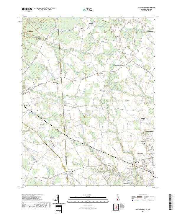
2023 Map of Seaford West
USGS Topo · Published 2023About this map
Reliance and Branchview sit at the crossroads of the Delaware Maryland state line, where the borders of Sussex, Caroline, and Dorchester counties converge. This landscape is defined by its intricate drainage networks, with numerous branches such as Houston Branch and Tanyard Branch feeding into larger wetlands like Whitney Swamp. The rural character of the area is emphasized by small settlements like Jacobs Crossroads and Clarksons Crossroads, which anchor the agricultural hinterlands surrounding the larger hub of Seaford. Local family history is deeply embedded in the land, evidenced by several small burial grounds including the Cannon Family Cem and Wright Cem. To the south, the industrial and residential expansion of the region is visible in Atlanta Estates and the presence of the Oak Grove Farm Airport, reflecting a mix of traditional Delmarva farming and modern local infrastructure.
Find a feature on this map
137 named features on this map. Tap any name to fly to it.
Don’t see what you’re looking for? This feature index may not catch every label — zoom into the map to look around manually.
Map Details
Editions of this 2023 Seaford West Map
This is the sole edition of this map. No revisions or reprints were ever made.
Other maps of this area

1905 · Denton
USGS Topo · 1:62,500

1905 · Hurlock
USGS Topo · 1:62,500

1915 · Seaford
USGS Topo · 1:62,500

1918 · Harrington
USGS Topo · 1:62,500

1944 · Federalsburg
USGS Topo · 1:31,680

1944 · Seaford
USGS Topo · 1:62,500

1944 · Hobbs
USGS Topo · 1:31,680
1944 · Rhodesdale
USGS Topo · 1:31,680
1944 · Harrington
USGS Topo · 1:62,500

1946 · Salisbury
USGS Topo · 1:250,000