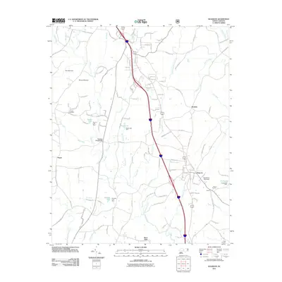
2011 Map of Seagrove
USGS Topo · Published 2011About this map
Seagrove anchors this Piedmont landscape, serving as a central hub for the surrounding rural communities during the early 21st century. The map details a complex network of water resources and small-scale infrastructure, including Slacks Lake Dam, Auman Lake Dam, and Wimbish Lake Dam. These impoundments, scattered along the upper reaches of the Little River and its numerous tributaries like Rocky Creek and Reed Creek, highlight the region's reliance on managed water systems.
Find a feature on this map
134 named features on this map. Tap any name to fly to it.
Don’t see what you’re looking for? This feature index may not catch every label — zoom into the map to look around manually.
Map Details
Editions of this 2011 Seagrove Map
This is the sole edition of this map. No revisions or reprints were ever made.
Other maps of this area

1942 · Troy
USGS Topo · 1:125,000

1953 · Raleigh
USGS Topo · 1:250,000

1954 · Raleigh
USGS Topo · 1:250,000

1957 · Troy
USGS Topo · 1:62,500

1957 · Asheboro
USGS Topo · 1:62,500

1968 · Ramseur
USGS Topo · 1:24,000

1968 · Erect
USGS Topo · 1:24,000

1970 · Asheboro
USGS Topo · 1:24,000
1973 · Eleazer
USGS Topo · 1:24,000

1973 · Seagrove
USGS Topo · 1:24,000