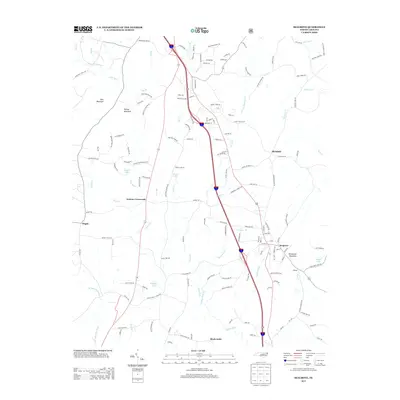
2013 Map of Seagrove
USGS Topo · Published 2013About this map
Seagrove serves as a primary hub in this portion of Randolph County, where the landscape is defined by the winding course of the Little River and its numerous tributaries. Small rural communities and named junctions like Aumans Crossroads, Michfield, and the curiously named Black Ankle are connected by a network of local roads such as Old NC Highway 13. The topography is punctuated by several distinct peaks, including Nancys Mountain and Needhams Mountain, which overlook a series of small water bodies like Slacks Lake and Auman Lake. This 2013 survey illustrates the modern layout of the region, balancing residential areas with the natural drainage patterns of Wagners Br and Kings Cr. The mapping of these small settlements and family-named landmarks provides a clear view of the area's contemporary geography and rural development.
Find a feature on this map
152 named features on this map. Tap any name to fly to it.
Don’t see what you’re looking for? This feature index may not catch every label — zoom into the map to look around manually.
Map Details
Editions of this 2013 Seagrove Map
This is the sole edition of this map. No revisions or reprints were ever made.
Other maps of this area

1942 · Troy
USGS Topo · 1:125,000

1953 · Raleigh
USGS Topo · 1:250,000

1954 · Raleigh
USGS Topo · 1:250,000

1957 · Troy
USGS Topo · 1:62,500

1957 · Asheboro
USGS Topo · 1:62,500

1968 · Ramseur
USGS Topo · 1:24,000

1968 · Erect
USGS Topo · 1:24,000

1970 · Asheboro
USGS Topo · 1:24,000
1973 · Eleazer
USGS Topo · 1:24,000

1973 · Seagrove
USGS Topo · 1:24,000