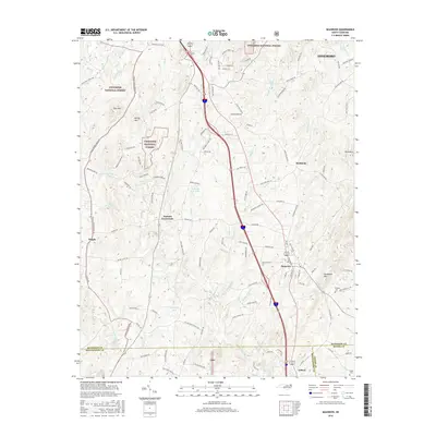
2016 Map of Seagrove
USGS Topo · Published 2016About this map
Seagrove serves as a focal point in this 2016 survey, situated at the junction of modern transit corridors and historic rural routes in southern Randolph County. The landscape is defined by the headwaters of the Little River and numerous small impoundments such as Blacks Lake and Wimbish Lake. The presence of Uwharrie National Forest to the west and significant peaks like Needhams Mtn and Pond Mtn suggests the varied elevation that shaped early settlement patterns. This area, known for its deep-rooted pottery traditions, is shown here through its network of small communities including Aumans Crossroads, Pisgah, and Michfield. Local history is anchored by sites such as the Whynot Cem and landmarks like the Pisgah Covered Bridge Rd, reflecting the intersection of family-named geography and the region's cultural heritage.
Find a feature on this map
126 named features on this map. Tap any name to fly to it.
Don’t see what you’re looking for? This feature index may not catch every label — zoom into the map to look around manually.
Map Details
Editions of this 2016 Seagrove Map
This is the sole edition of this map. No revisions or reprints were ever made.
Other maps of this area

1942 · Troy
USGS Topo · 1:125,000

1953 · Raleigh
USGS Topo · 1:250,000

1954 · Raleigh
USGS Topo · 1:250,000

1957 · Troy
USGS Topo · 1:62,500

1957 · Asheboro
USGS Topo · 1:62,500

1968 · Ramseur
USGS Topo · 1:24,000

1968 · Erect
USGS Topo · 1:24,000

1970 · Asheboro
USGS Topo · 1:24,000
1973 · Eleazer
USGS Topo · 1:24,000

1973 · Seagrove
USGS Topo · 1:24,000