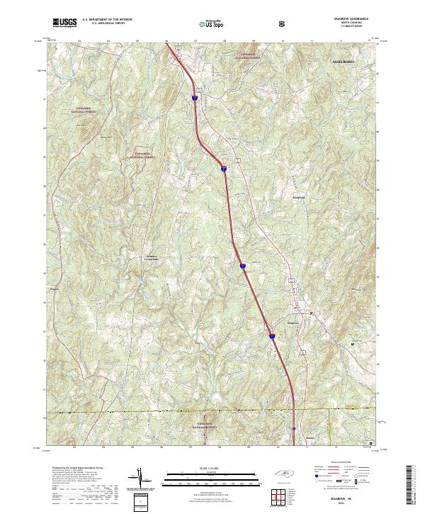
2022 Map of Seagrove
USGS Topo · Published 2022About this map
The Uwharrie National Forest anchors the western portion of this Central North Carolina landscape, where the terrain transitions from the elevations of Kies Mtn and Nancys Mtn down toward the winding waters of the Little River. This 2022 survey captures the rural character of southeastern Randolph County, centered on the historic pottery hub of Seagrove. The map details a network of family-named crossroads and smaller communities like Aumans Crossroads and Michfield, reflecting a long-standing pattern of dispersed settlement along routes like the Seagrove Plank Rd.
Find a feature on this map
122 named features on this map. Tap any name to fly to it.
Don’t see what you’re looking for? This feature index may not catch every label — zoom into the map to look around manually.
Map Details
Editions of this 2022 Seagrove Map
This is the sole edition of this map. No revisions or reprints were ever made.
Other maps of this area

1942 · Troy
USGS Topo · 1:125,000

1953 · Raleigh
USGS Topo · 1:250,000

1954 · Raleigh
USGS Topo · 1:250,000

1957 · Troy
USGS Topo · 1:62,500

1957 · Asheboro
USGS Topo · 1:62,500

1968 · Ramseur
USGS Topo · 1:24,000

1968 · Erect
USGS Topo · 1:24,000

1970 · Asheboro
USGS Topo · 1:24,000
1973 · Eleazer
USGS Topo · 1:24,000

1973 · Seagrove
USGS Topo · 1:24,000