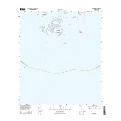
2015 Map of Seahorse Key
USGS Topo · Published 2015About this map
Atsena Otie Key and Seahorse Key anchor this maritime survey of the archipelago off the Florida coast. This map documents a landscape defined by shifting sands and isolated landforms, including the Atsena Otie Cem, a site of significant genealogical and local interest. The surrounding waters of the Gulf of Mexico are navigated via the Main Ship Channel and Deadmans Channel, which cut between the various islands known collectively as the Cedar Keys. To the south, the seafloor is marked by the broad West Bank and East Bank, leading toward the extensive Seahorse Reef. The map illustrates the specialized geography of the Levy County coastline, where small islands like Snake Key, North Key, and Grassy Key provide the only terrestrial markers in an otherwise aquatic environment.
Find a feature on this map
20 named features on this map. Tap any name to fly to it.
Don’t see what you’re looking for? This feature index may not catch every label — zoom into the map to look around manually.
Map Details
Editions of this 2015 Seahorse Key Map
This is the sole edition of this map. No revisions or reprints were ever made.
Other maps of this area

1954 · Gainesville
USGS Topo · 1:250,000

1955 · Seahorse Key
USGS Topo · 1:24,000

1955 · Cedar Key
USGS Topo · 1:24,000

1955 · Sumner
USGS Topo · 1:24,000

1955 · Plant City
USGS Topo · 1:250,000

1958 · Plant City
USGS Topo · 1:250,000

1958 · Gainesville
USGS Topo · 1:250,000

1959 · Plant City
USGS Topo · 1:250,000

1959 · Gainesville
USGS Topo · 1:250,000

1964 · Plant City
USGS Topo · 1:250,000