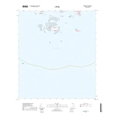
2018 Map of Seahorse Key
USGS Topo · Published 2018About this map
Seahorse Key and the surrounding islands of the Cedar Keys cluster emerge from the shallow coastal waters of the Gulf of Mexico in this modern survey of Levy County. The topography is dominated by a complex network of mangrove-lined keys and shifting sandbars, including Deadmans Key and Snake Key. For those researching local history, the map identifies the Atsena Otie Cem on Atsena Otie Key, a site reflecting the early settlement patterns and the maritime industry that once thrived in these waters. Navigational features such as the Main Ship Channel, Deadmans Channel, and the sweeping line of Seahorse Reef illustrate the maritime routes essential for reaching this island group. The landscape transitions from the submerged West Bank and East Bank to the low-lying terrain of North Key and Grassy Key, providing a detailed look at the island geography and coastal boundaries of this unique Florida archipelago.
Find a feature on this map
17 named features on this map. Tap any name to fly to it.
Don’t see what you’re looking for? This feature index may not catch every label — zoom into the map to look around manually.
Map Details
Editions of this 2018 Seahorse Key Map
This is the sole edition of this map. No revisions or reprints were ever made.
Other maps of this area

1954 · Gainesville
USGS Topo · 1:250,000

1955 · Seahorse Key
USGS Topo · 1:24,000

1955 · Cedar Key
USGS Topo · 1:24,000

1955 · Sumner
USGS Topo · 1:24,000

1955 · Plant City
USGS Topo · 1:250,000

1958 · Plant City
USGS Topo · 1:250,000

1958 · Gainesville
USGS Topo · 1:250,000

1959 · Plant City
USGS Topo · 1:250,000

1959 · Gainesville
USGS Topo · 1:250,000

1964 · Plant City
USGS Topo · 1:250,000