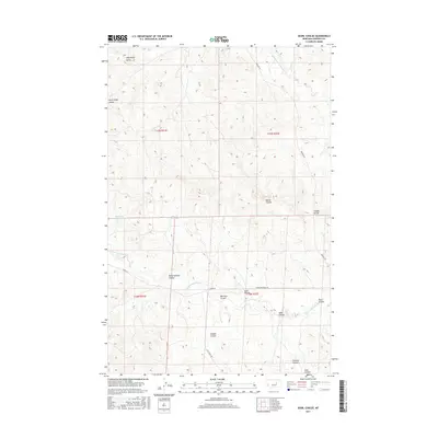
2017 Map of Searl Coulee
USGS Topo · Published 2017About this map
Battleship Butte stands as a prominent landmark in this Garfield County landscape, overlooking a series of deeply etched drainages and coulees. The terrain is defined by the complex hydrography of the Middle Fork Lodgepole Cr and S Fork Lodgepole Cr, which have carved the surrounding prairie into numerous named features. This survey captures a rural Montana environment where water management is critical for local ranching and agriculture, as evidenced by the placement of the Mashesky Reservoir and Stroud Reservoir.
Find a feature on this map
24 named features on this map. Tap any name to fly to it.
Don’t see what you’re looking for? This feature index may not catch every label — zoom into the map to look around manually.
Map Details
Editions of this 2017 Searl Coulee Map
This is the sole edition of this map. No revisions or reprints were ever made.
Other maps of this area

1954 · Jordan
USGS Topo · 1:250,000

1956 · Jordan
USGS Topo · 1:250,000

1958 · Jordan
USGS Topo · 1:250,000

1964 · Jordan
USGS Topo · 1:250,000
1967 · Barney Pinnacle
USGS Topo · 1:24,000
1967 · Froehlich Butte
USGS Topo · 1:24,000
1967 · Cox Butte
USGS Topo · 1:24,000
1967 · Coffin Butte
USGS Topo · 1:24,000
1967 · Hay Coulee
USGS Topo · 1:24,000
1967 · Searl Coulee
USGS Topo · 1:24,000