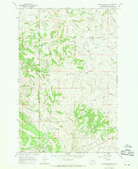
1967 Map of Barney Pinnacle
USGS Topo · Published 1970About this map
Barney Pinnacle rises above a landscape of deeply etched drainages and ranching outposts in Garfield County during the late 1960s. This survey records a rugged terrain defined by extensive coulee systems, where isolated operations like the Matovich Ranch and Peterson Ranch anchored the local economy. The presence of a Refinery, Powerplant, and a Landing Field near Script Coulee suggests an era of energy development and industrial utility amidst the traditional grazing lands of eastern Montana.
Find a feature on this map
26 named features on this map. Tap any name to fly to it.
Don’t see what you’re looking for? This feature index may not catch every label — zoom into the map to look around manually.
Map Details
Editions of this 1967 Barney Pinnacle Map
This is the sole edition of this map. No revisions or reprints were ever made.
Other maps of this area

1954 · Jordan
USGS Topo · 1:250,000

1954 · Forsyth
USGS Topo · 1:250,000

1956 · Jordan
USGS Topo · 1:250,000

1957 · Forsyth
USGS Topo · 1:250,000

1958 · Jordan
USGS Topo · 1:250,000

1958 · Forsyth
USGS Topo · 1:250,000

1962 · Mosby
USGS Topo · 1:24,000
1963 · Hill Ranch
USGS Topo · 1:24,000
1963 · Dutton Ranch
USGS Topo · 1:24,000

1964 · Jordan
USGS Topo · 1:250,000