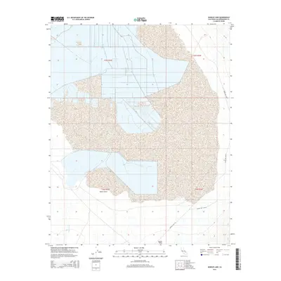
2015 Map of Searles Lake
USGS Topo · Published 2015About this map
Searles Lake dominates this portion of the northern Mojave Desert, revealing a complex landscape of dry lake beds and drainage patterns. The map highlights the vast, arid expanse of the Searles Valley, where the geometric grid of modern land surveying meets the irregular natural boundaries of Teagle Wash. The area is defined by its industrial and transport infrastructure, centered around the salt pan and its surrounding mineral-rich basin. Regional access is dictated by the corridors of Searles Valley Rd and Searles Dry Lake Rd, which provide the primary links through this specialized desert environment. The stark separation between the playa surfaces and the surrounding alluvial fans illustrates the distinct geological character of this San Bernardino County sink.
Find a feature on this map
10 named features on this map. Tap any name to fly to it.
Don’t see what you’re looking for? This feature index may not catch every label — zoom into the map to look around manually.
Map Details
Editions of this 2015 Searles Lake Map
This is the sole edition of this map. No revisions or reprints were ever made.
Other maps of this area

1915 · Searles Lake
USGS Topo · 1:250,000

1947 · Trona
USGS Topo · 1:250,000

1948 · Trona
USGS Topo · 1:250,000

1949 · Trona
USGS Topo · 1:62,500

1949 · Searles Lake
USGS Topo · 1:62,500

1950 · Searles Lake
USGS Topo · 1:62,500

1950 · Trona
USGS Topo · 1:62,500

1950 · Manly Peak
USGS Topo · 1:62,500

1950 · Wingate Pass
USGS Topo · 1:62,500

1951 · Wingate Pass
USGS Topo · 1:62,500