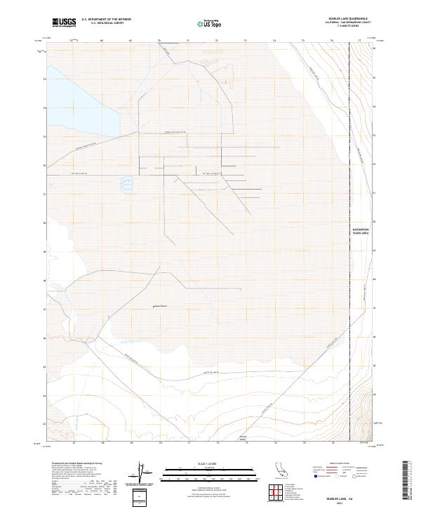
2021 Map of Searles Lake
USGS Topo · Published 2021About this map
The Mojave Desert floor dominates this survey of the northern Searles Valley, showing a landscape defined by industrial resource extraction and arid terrain. The map detail centers on the dry bed of Searles Lake, where an intricate network of specialized roads facilitates access to remote facilities. Features such as Salt Well Access Rd, Pumping Station Access Rd, and Pipeline Rd trace the movement of minerals and water through this corner of San Bernardino County. These infrastructure labels imply the active chemical and mineral harvesting operations that have historically characterized the region. Along the southern margins, the topography transitions toward Teagle Wash, while established routes like Searles Dry Lake Rd and Searles Valley Rd provide the primary transit corridors through the desert flats.
Find a feature on this map
13 named features on this map. Tap any name to fly to it.
Don’t see what you’re looking for? This feature index may not catch every label — zoom into the map to look around manually.
Map Details
Editions of this 2021 Searles Lake Map
This is the sole edition of this map. No revisions or reprints were ever made.
Other maps of this area

1915 · Searles Lake
USGS Topo · 1:250,000

1947 · Trona
USGS Topo · 1:250,000

1948 · Trona
USGS Topo · 1:250,000

1949 · Trona
USGS Topo · 1:62,500

1949 · Searles Lake
USGS Topo · 1:62,500

1950 · Searles Lake
USGS Topo · 1:62,500

1950 · Trona
USGS Topo · 1:62,500

1950 · Manly Peak
USGS Topo · 1:62,500

1950 · Wingate Pass
USGS Topo · 1:62,500

1951 · Wingate Pass
USGS Topo · 1:62,500