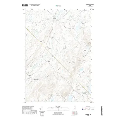
2018 Map of Searsmont
USGS Topo · Published 2018About this map
The Saint George River serves as the primary drainage through this mid-coast Maine landscape, winding past the village center of Searsmont and southward through Ghent. This area is defined by its prominent ridges, particularly Appleton Ridge and Muzzy Ridge, which run parallel to the river valley. The map reveals a dense network of family-named landmarks and cemeteries, suggesting a long history of rural settlement and farming. Small clusters of development appear at crossroads such as Shermans Mill, North Appleton, and Hope.
Find a feature on this map
93 named features on this map. Tap any name to fly to it.
Don’t see what you’re looking for? This feature index may not catch every label — zoom into the map to look around manually.
Map Details
Editions of this 2018 Searsmont Map
This is the sole edition of this map. No revisions or reprints were ever made.
Other maps of this area

1904 · Rockland
USGS Topo · 1:62,500

1906 · Rockland
USGS Topo · 1:62,500

1913 · Waldoboro
USGS Topo · 1:48,000

1915 · Waldoboro
USGS Topo · 1:62,500

1915 · Belfast
USGS Topo · 1:62,500

1916 · Liberty
USGS Topo · 1:62,500

1917 · Belfast
USGS Topo · 1:62,500

1941 · Belfast
USGS Topo · 1:62,500

1941 · Rockland
USGS Topo · 1:62,500

1941 · Waldoboro
USGS Topo · 1:62,500